.

Thursday, 21 August 2014

September 2014 - Ben Lomond, Tyndrum and Killin

Following last years successful Munro bagging trip last September, with my good friend John Parkin, we are planning to repeat in October 2014 what we hope will be at least an annual event.

All of last years walks were expertly planned by John using Ralph Storers "The Ultimate Guide to the Munros, Vol 1" resulting in a grand total of 12 Munros bagged over 6 walks within a 9 day walking window, using this same book to plot this years routes outlined in this post below.

We will be meeting up for a similar period, but for me ever looking to squeeze in an extra few days, I will be coming up 1 week earlier to catch up on a couple of Munros John has completed , including Ben Lomond, as well as maybe a couple of isolated Munros around Crianlarich and/or Tyndrum.

It really is too far to drive from Suffolk for a trip of less than 2 weeks.


First week alone
Following on from my Cuillin Ridge trip last May and failing to complete 1 walk due to being both physically and mentally tired I am planning a less ambitious schedule for this first week allowing a rest day every other day. This means a maximum of three walks for which I will plan in detail including Ben Lomond. The aim of this first week will be to prepare me for the following 10 days with John as opposed to exhausting me. This is especially important as at time of writing (end August) I am recovering from sciatica and will be undergoing intensive rehab during mid september in preparation for this trip and using the first week to recover my hill fitness.

It looks like I may also be delayed by a couple of days and John may come up earlier meaning at best I will only have time for 2 walks. The plan is therefore to go up Ben Lomond on the first walk while I am still fresh to catch up on one of the Munros John has already done. Then make my way up to Tyndrum and after a suitable rest period do a less demanding walk to increase my Corbett count by going up Beinn Bhreac-liath between Tyndrum and Bridge of Orchy.

If it transpires that John arrives before I get a chance to do Beinn Bhreac-liath I think our time will be better spent by starting the Munro walks early allowing maybe a slot later in the trip knocking of a couple of the more isolated Munros. Either by wild camping in the vans near Loch an Daimh and picking off Meall Buidhe and Stuc an Lochain or walking in to the West of Loch Lyon and going for Beinn a' Chreachain and Beinn Mhanach with an over-night bivvy out.

Rowardennan
Ben Lomond
Route Information
Start Point - Rowardennan (GR - NS 35965 98625)
Start Height - 17.37m
Finish Point - Rowardennan (GR - NS 35965 98625)
Finish Height - 17.37m
Distance Walked - 7.44miles
Height Ascended - 1011.79metres
Duration - 5hrs 50mins [based on average pace 1.75mph + 1hr 0mins added per 600m of ascent]

Route
Ben Lomond is the most southerly Munro and therefore like thousands of other baggers is my closest Munro. After Ben Nevis, mainly because of its proximity to Glasgow, it is also the second most climbed Munro. and therefore has a well established tourist route that leads to the summit in under 4 miles of relatively straight forward walking making a total up and down walk of 8 miles.
There is also an alternative route via its associated Corbet Top - Ptarmigan. It is slightly more difficult due to some minor scrambling needed on the westerly approach to Ben Lomond but is slightly less distance. This is the approach I will take as it allows me to bag an extra peak keeps the scrambling in an uphill direction and creates the all important circular route by returning down the Tourist Route.

Corbett - Beinn Bhreac-liath
Route Information
Start Point - By the Way, Tyndrum (GR - NN 32825 30112)
Start Height - 231.56m
Finish Point - Bridge of Orchy Rail Station (GR - NN 30030 39438)
Finish Height - 187.39m
Distance Walked - 7.86miles
Height Ascended - 733.15metres
Duration - 5hrs 39mins [based on average pace 1.75mph + 1hr 0mins added per 600m of ascent]

Route

This will only be the second walk of my trip so do not want a walk that is going to over exert me. Hence keeping the distance down and total ascent at a modest level. If I am joined by John before getting a chance to do this walk I will leave it for a later lone visit and suggest we go for the Ben More route with Stob Binnein. Even with the inclusion of the Munro Top of Stob Coire an Lochain it is less distance but of course significantly more ascent. Evenso with trip preparation in gym am sure will not be too much. I will make sure I have a rest day before John arrives and will have the option of a rest day next day.

The preferred route for this walk is to catch the train from Tyndrum Upper to Bridge of Orchy and walk back. If however for some reason I do not manage to get up in time to catch the West Highland train from Glasgow to Fort William at 10:25. I will start the walk from Tyndrum following the route in reverse visiting Beinn Bhreac-liath via  Beinn Bheag. From Beinn Bhreac-liath I will assess the descent down the it's southern ridge through the pine forest returning to Tyndrum via the A85 to Oban.

Next 12 days with John Parkin
Tyndrum
The Tyndrum Grandslam
Route Information
Start Point - Dalrigh (GR - NN 34415 29120)
Start Height - 189.04.05m
Finish Point - Glen Lochy Car Park on A85 (Airigh nan Cioch) (GR - NN 23922 27835)
Finish Height - 190.12m
Distance Walked - 11.71miles
Height Ascended - 1704.06metres
Duration - 9hrs 21mins [based on average pace 1.75mph + 1hr 0mins added per 600m of ascent]

Route


During my last visit to Tyndrum I could see the four Munros including Ben Lui and Ben Oss from what I called the Tyndrum Handful and thought they could all be maybe done in one go. After some route planning using amongst others, Ralph Storers Ultimate Guide to the Munros, and recognising my own limitations I know a circular route in excess of 18 miles from Dalrigh would be too much. Both in terms of time and daylight hours available but more importantly my own physical capabilities
With two vehicles and a linear walk from Dalrigh to the car park on the A85 near Airigh nan Cioch 12 miles and 1700m of ascent seems more within physical capabilities and with an early start should be achievable in daylight hours especially when compared to the Tyndrum Handful which took 12 hours and was 15½ miles with over 2000m of ascent.
In the event it does take longer there is the option to take an exit routes back to Dalrigh leaving Ben Lui and Ben a' Chleibh for another day. With the most difficult part of the route being through the boggy path through the pine trees of Coille Coire Chillic I would expect this to be triggered if we are not at Ben Oss by by mid way through available daylight hours. (Max 11 hours in October)

Cruach Ardrain & Beinn Tulaichean
Route Information
Start Point - Community Woodland car park, Crianlarich (GR - NN 38930 25107)
Start Height - 162.68m
Finish Point - Community Woodland car park, Crianlarich (GR - NN 38930 25107)
Finish Height - 162.68m
Distance Walked - 10.58miles
Height Ascended - 1279.950metres
Duration - 8hrs 03mins [based on average pace 1.75mph + 1hr 0mins added per 600m of ascent]

Route

Both the Ben More and the Cruach Ardrain routes could be walked from Killin but are closer to Tyndrum so have been included as walks based at Tyndrum. As Cruach Ardrain is the closer of the two hopefully we will get at least this walk in from Tyndrum should bad weather restrict the walking days available whilst based in Tyndrum.
Starting at the community car park on the A85 out of Crianlarich and navigating forest tracks through woods to Meall an Fhreiceadain below Grey Height (neither of which are peaks) the 1000m plus Cruach Ardrain is the highlight of the days walk with the added bonus of tagging the relatively isolated Munro of Beinn Tulaichean on as well. Failing that it will be an up and down walk with an extra day to pick up Beinn Tulaichean from Inverlochlarig after a long drive round to Balquidder. I suppose on the plus side though we could pull in some history visiting Rob Roy’s grave in Balquidder and sight of his house in Inverlochlarig. Maybe will do that anyway, sounds like a days activity without tagging on a walk. If we do manage both Munros it will turn out to be a productive walk in terms of extra peaks because rather than returning after the climb back up to Cruach Ardrain we can cut right at the Bealach between Cruach Ardrain and Beinn Tulaichean via Stob Garbh and Stob Coire Bhuidhe making a total of 7 peaks including 2 ex- Munro Tops.

Ben More & Stob Binnein
Route Information
Start Point - Benmore Farm (GR - NN 41400 25897)
Start Height - 162.27m
Finish Point - Benmore Farm (GR - NN 41400 25897)
Finish Height - 162.27m
Distance Walked - 7.43miles
Height Ascended - 1414.60metres
Duration - 6hrs 25mins [based on average pace 1.75mph + 1hr 0mins added per 600m of ascent]

Route

From Benmore Farm we have a choice of clockwise up the steep NW ridge or a shallower approach along Ben More Glen. My preference is to attack the steep ground first bagging Ben More first followed by Stob Binnein we then have the option to do the "there and back walk and go for the Munro Top of Stob Coire an Lochain if we still have the energy before returning to Bealach-eardar-dha Beinn and back to Benmore Farm along Benmore Glen.
At a total distance of only 7½ miles including Stob Coire an Lochain I reckon  the one thing that would stop us is if the weather took a turn for the worse.

Killin
Ben Lawers ridge
Route Information
Start Point - Visitors Car Park on road to Lochain Na Lairige (GR - NN 60830 37910)
Start Height - 431.96m
Finish Point - Machium (GR - NN 67992 39955)
Finish Height - 186.06m
Distance Walked - 10.19miles
Height Ascended - 1328.08metres
Duration - 7hrs 54mins [based on average pace 1.75mph + 1hr 0mins added per 600m of ascent]

Route

With the benefit of two vehicles a point to point walk from the Ben Lawers visitor centre car park to Machuim on the A827 between Killin and Aberfeldy gives us the chance to bag 5 Munros in one expedition. Given fair weather a total distance of just over 10km and 1300m of ascent keeps the attempt well within physical capabilities. There is opportunities to head back to the start point if the weather does take a turn for the worst but I would say the point of no return would be somewhere around An Stac where it would be better to press on and take the exit route at Lairig Innein leaving Meall Greig for another day if energy or daylight is short.
As an alternative we could consider starting at Machium. This direction may be more preferable if we decide it is better to scramble up the gully on An Stac NE ridge rather than shimmy down it. But once down the hardest terrain Between Ben Lawers and An Stac is behind us rather than once up ahead.

Meall Corranaich & Meall a'Choire Leith
Route Information
Start Point - Cairn at 549m spot height on Lochan na Lairige road (GR - NN 59365 41600)
Start Height - 565.13m
Finish Point - Cairn at 549m spot height on Lochan na Lairige road (GR - NN 59365 41600)
Finish Height - 565.13m
Distance Walked - 6.12miles
Height Ascended - 775.61metres
Duration - 4hrs 43mins [based on average pace 1.75mph + 1hr 0mins added per 600m of ascent]

Route

From the map this looks fairly straight forwards walking anti-clockwise. There is mention of boggy terrain in the guide book but once the wall has been found near Meall Corranaich point 669m sub Graham Top navigation following the wall all the way to the main summit of Meall Corranaich should not be a problem.
Not withstanding the 300m descent to bealach between Meall Corranaich and Meall a'Choire Leith the ridge walk should also be straight forward as long as we stay right/north and not be tempted down the NW ridge in to Coire Gorm.
It seems the main problem will be the boggy ground at the beginning and more particularly at the end of the walk. Energy permitting it may be preferable to stay north of Allt Gleann Da-Eig tributary and pull in the Corbett Meall nam Maigheach thereby avoiding the worst boggy ground between the two sub Graham Tops of Meall nan Eun and Meall Corranaich point 669m. But to be honest it may just be an excuse to bag an extra peak as I suspect it is only a case of delaying the boggy ground which probably can not be avoided. Perhaps it is a case of taking a pair of old trainers for the last few hundred yards and avoiding giving the boots a good old soaking over their tops. 

Thursday, 15 May 2014

Cuillin Ridge Day04 - Sgùrr nan Gillean & Bruach na Frithe

Walk Summary
Big day for me today as had to get back on the hill after coming off early two days earlier on Sgùrr a'Mhadaidh. With a rest day yesterday, extra support from the ML and rest of group I was fine and manged a roped descent down a shoulder of volcanic rock and an abseil down Tooth Chimney. Not only that it was pouring with rain and strong south westerly winds. Not to mention improvised winter skills over snow banks which have usually long gone by May in previous years. Because of the wet and wind we had to abandon plans to ascend Am Bastier as the ascent is not only exposed but like soap on the Basalt dikes. A fantastic day and proof I was back on the hill but with the loss of Am Bastier, InPin as well as the two peaks from Day 03 meant I only managed 7 of the 11 peaks. The rest of the group managed 9 though which considering the conditions for the week was a good haul and remarkable achievement for the ML to get us over that many. 
A fantastic week. 

Many thanks to Iain Gallagher ML Kendal Mountaineering Services).

Walk Description 
Setting 

Kendal Mountaineering Services blog page
If like me you are just the average hill walker with no climbing expertise and limited scrambling experience, but have set yourself the target to climb all the Munros. Have you thought about how you will reach the 11 Munros on the Cuillin Ridge, Isle of Skye. From what I have read and now seen you will have no chance unless you know an experienced climber with knowledge of the Cuillins. Iain Gallagher of Kendal Mountaineering Services is just such a man. He has a lifetime of mountaineering experience along with a detailed knowledge of the Cuillins including safe scrambling routes along with entry and exit routes to take the safest option whatever the conditions might be or indeed change whilst out on the hill.

I found his services on line and paid the £425 for one weeks accommodation and 4 days guided walking (scrambling and climbing) in the Cuillins. Excellent value. 4 days guided walking alone could cost you that much. This price really includes food as well, because each member of the group, including Iain, supply a home cooked meal each day, creating a brilliant atmosphere and get together at the end of the day with everyone else in the team.

Team is just what you are part of, supporting each other throughout the day ensuring each and every one of us reaches our own goals as well as at times extend outside your own comfort zone and edge of achievable limits.

A brilliant experience. No kickbacks or commissions, but I cannot recommend this trip highly enough and thank Iain most sincerely for enabling me to extend myself beyond limits I never thought possible. As I have read somewhere "you do not know your limits or what you are capable of achieving  until you start to venture beyond your limits."

Iain provided the opportunity and maintained the safe environment to do just that.

As well as taking copious amounts of photographs he also records the days events on his own blog to provide lasting memories of a trip of a lifetime. Here is his account of Day04 activities on the Cuillin Ridge - Sgurr Nan Gillean to Bruach Na Frithe 

Walk Statistics
Walk Date - 15 May 2014
Walkers - Iain Gallagher (ML Kendal Mountaineering Services), Steve Smith, Al Simpson, Helen McD, Don, Alison L
Accommodation - Carbost, Isle of Skye
Start Point - Layby on A863 near Sligaachan Hotel (NG 48380 29754)
Start Time - 09:02
Finish Point - Layby on A863 near Sligaachan Hotel (NG 48380 29754)
Finish Time - 18:32
Duration - 9hrs 30mins
Average pace - 0.87mph
Distance Walked - 8.25miles
Height Ascended - 1251.32metres

Other walks on this trip
2014
May
08th The Tyndrum Handful
11th Cuillin Ridge Day01 - Sgùrr nan Eag, Sgùrr Dubh Mòr & Sgùrr Alasdair
12th Cuillin Ridge Day02 - Sgùrr Mhic Choinnic

13th Cuillin Ridge Day03 - Sgùrr a'Mhadaidh
15th 
Cuillin Ridge Day04 - Sgùrr nan Gillean & Bruach na Frithe

18th Comb Moss

Peaks visited
Munro (282)
Sgùrr nan Gillean (18)
Bruach na Frithe (19)
Murdo (443)
Sgùrr nan Gillean (26)
Bruach na Frithe (27)
Corbett (221)
NONE
Graham (224)
NONE
Marilyn (1218S - 1552E,W&S))
Sgùrr nan Gillean (19S - 90E,W&S)
Hump (2168S - 2976E,W&S)
Sgùrr nan Gillean (23S - 144E,W&S)
Bruach na Frithe (24S - 145E,W&S)
Route
Our days route as plotted on my GPS tracklog.
Please do not think without the necessary experience or knowledge of The Cuillins this is the basis of a route you can tackle alone or even part of a determined group. The contours are simply too close together along with scree, outcrop, boulder and loose rock symbols so arbitrary, that plotting a route from your armchair or even on the ground are just too complex.

More Photographs
Not having a lot of luck with my camera on this trip. Turned on camera to take photos of setting off at start of walk and battery was flat.
Once again I am without my own camera so only photos taken by me are on my smartphone.
Remaining photos taken by other members of group and in particular Iain Gallagher of Kendal Mountaineering Services .


Heading towards Sgùrr Dearg - The Inaccessible Pinnacle shrouded in cloud and probably rain
Click on photograph to view slide-show

Tuesday, 13 May 2014

Cuillin Ridge Day03 - Sgùrr a'Mhadaidh

Walk Summary
Summit photo on Sgùrr a'Mhadaidh.
Today was the day I reached and experienced the limits of my comfort zone on the mountain. The highs and exhilaration of the previous 2 days had exhausted my adrenalin and maybe serotonin management to the point where I had to return to safer ground after the first summit. Could it be after 20 years since it was prescribed I am finally realising that I do need to take fluoxetine.
Despite assurances from the ML that I was doing fine and that I could be roped up for more of the ridge walking I just felt it was better for the group if I returned to the car from the next safe point rather than go on and be a burden further on in the walk. Big disappointment for me and I know the rest of the team, but while I have some regrets now know it was the correct decision at the time. As always the mountains will be there another day and I will be back for them. Only Munro for me today; Sgùrr a' Mhadaidh Two more for the rest of the group; Sgùrr a'Ghreadaidh & Sgùrr Sgurr na Banachdich.

Kendal Mountaineering Services blog page
If like me you are just the average hill walker with no climbing expertise and limited scrambling experience, but have set yourself the target to climb all the Munros. Have you thought about how you will reach the 11 Munros on the Cuillin Ridge, Isle of Skye. From what I have read and now seen you will have no chance unless you know an experienced climber with knowledge of the Cuillins. Iain Gallagher of Kendal Mountaineering Services is just such a man. He has a lifetime of mountaineering experience along with a detailed knowledge of the Cuillins including safe scrambling routes along with entry and exit routes to take the safest option whatever the conditions might be or indeed change whilst out on the hill.

I found his services on line and paid the £425 for one weeks accommodation and 4 days guided walking (scrambling and climbing) in the Cuillins. Excellent value. 4 days guided walking alone could cost you that much. This price really includes food as well, because each member of the group, including Iain, supply a home cooked meal each day, creating a brilliant atmosphere and get together at the end of the day with everyone else in the team.

Team is just what you are part of, supporting each other throughout the day ensuring each and every one of us reaches our own goals as well as at times extend outside your own comfort zone and edge of achievable limits.

A brilliant experience. No kickbacks or commissions, but I cannot recommend this trip highly enough and thank Iain most sincerely for enabling me to extend myself beyond limits I never thought possible. As I have read somewhere "you do not know your limits or what you are capable of achieving  until you start to venture beyond your limits."

Iain provided the opportunity and maintained the safe environment to do just that.

As well as taking copious amounts of photographs he also records the days events on his own blog to provide lasting memories of a trip of a lifetime. Here is his account of Day03 activities on the Cuillin Ridge - Sgurr A' Mhadaidh to Sgurr Na Banachdich 

Walk Statistics
Walk Date - 13 May 2014
Walkers - Iain Gallagher (ML Kendal Mountaineering Services), Steve Smith, Al Simpson, Helen McD, Don, Alison L
Accommodation - Carbost, Isle of Skye
Start Point - Off road parking opposite Glen Brittle Hut (NG 41170 21567)
Start Time - 09:20
Finish Point - Off road parking opposite Glen Brittle Hut (NG 41170 21567)
Finish Time - 19:10
Duration - 9hrs 50mins
Average pace - 0.72mph
Distance Walked - 7.06miles
Height Ascended - 1521.01metres

Other walks on this trip
2014
May
08th The Tyndrum Handful
11th Cuillin Ridge Day01 - Sgùrr nan Eag, Sgùrr Dubh Mòr & Sgùrr Alasdair
12th Cuillin Ridge Day02 - Sgùrr Mhic Choinnic

13th Cuillin Ridge Day03 - Sgùrr a'Mhadaidh
15th 
Cuillin Ridge Day04 - Sgùrr nan Gillean & Bruach na Frithe

18th Comb Moss

Peaks visited
Munro (282)
Sgùrr a'Mhadaidh (17)
Murdo (443)
Sgùrr a'Mhadaidh (25)
Corbett (221)
NONE
Graham (224)
NONE
Marilyn (1218S - 1552E,W&S))
NONE
Hump (2168S - 2976E,W&S)
NONE

Route
Our days route as plotted on my GPS tracklog.
Please do not think without the necessary experience or knowledge of The Cuillins this is the basis of a route you can tackle alone or even part of a determined group. The contours are simply too close together along with scree, outcrop, boulder and loose rock symbols so arbitrary, that plotting a route from your armchair or even on the ground are just too complex.

More Photographs
Near walks finish,
looking backalong Allt a' Choire Ghreadaidh. Corbett Top of Munro Sgùrr a' Mhadaidh - Sgùrr Thuilm in distance
Click on photograph to view slide-show
Managed my camera today on what is the best day for weather so far. Too bad I did not manage to complete all summits. 
Here are some photos taken by other members of group on summits I did not reach, apologies for no captions.


Sgurr Na Banachdich Summit.
Sgurr a Ghreadaidh Summit.


Monday, 12 May 2014

Cuillin Ridge Day02 - Sgùrr Mhic Choinnic

Walk Summary
The summit party at Eas Mòr falls,
en route to Sgùrr Mhic Choinnic
After yesterdays 11½ hour epic Iain of Kendal Mountaineering Services had read the mood of the group and determined to have a shorter walk today.

The days objective was therefore a little less ambitious (only just) with the first Munro of the day being Sgùrr Mhic Choinnic followed by Sgùrr Dearg and the Inaccessible Pinnacle concluding with Sgùrr na Banachdich if it is not too late.

Although I still trailed  behind everyone else for most of the day I was feeling much stronger than yesterday with the reduced pack weight having dumped winter fleeces and storm shelter which was really duplicated elsewhere within the group.

Walk Description 
Setting off from opposite the BMC Glen Brittle Memorial Hut the day once again started on an easy to follow path which very quickly led to the first highlight of the day - The Eas Mòr Waterfalls.

Continuing on the path and keeping right we were soon passing
Isle of Rùm from Loch an Fhir-bhallaic
Loch an Fhir-bhallaich and marvelling at views to the south towards Canna and Rùm. Soon afterwards we joined the path up Coire Làgan and the route we descended last night from Loch Làgan. Once again we had an early lunch to replenish energy reserves used to get back to where we reached last night. For the more adventurous there is definitely a case to bivvy up on the shores of Loch Làgan to save the 4½ mile and 4 hour hike back to sea level in Glen Brittle then return next day to Loch Làgan. It really puts the scale of the Munros in to perspective. At just over 600m it is mighty close to the magic 2000’ signifying an English Nuttall where in many cases we would have reached our first summit and looking for the next. Here we still had another 1000’ to ascend and the prospect of some scrambling if not a climb before reaching our first summit.


The scale of ascent up days first Munro,
Sgùrr Mhic Choinnic SE of bealach.
Orange man in gully on buttress dead centre ahead.
We resumed our ascent more or less retracing our steps from last night over scree. But instead of veering right to the 1 in 2 slope up The Great Stone Chute we had a gentle ascent across the bottom of An Stac Screes followed by some relatively straight forward scrambling to bring us to the bealach between Sgùrr Mhic Choinnic and Sgùrr Dearg. Here we came across a shallow circular rock shelter where we dumped our back packs for the final ascent to Sgùrr Mhic Choinnic. So far the weather had been favourable but more or less on cue the cloud closed in followed by steady drizzle, the sort that soaks you, resulting in us having to don waterproof tops. Worse still the sort that could abort the attempt on InPin to our left but first we had the final ascent up the dauntingly large buttress to our left and ridge walk along the top of Coireachan Ruadha Crags to the summit. 


Ridge walk on way back from Sgùrr Mhic Choinnic summit
From here it is a grade 2 scramble picking a route around the top of the buttress then crossing the ridge to the other side and an exposed traverse with Coir’- uisg nearly 3000’ sheer drop below. Fortunately the cloud swirling around us obscured this for most of the time, but what I was learning was not to become too hung up about the consequences while at the same time taking the utmost care. Fortunately we were in the expert hands of Kendal Mountaineering Services at all times, who carefully supervised every one along this difficult part. Surely we must be nearly at the summit I thought. But no it was time to get the ropes out for an assisted climb to the final part of the ridge. These Cuillin Munros do not give up their prize easily. Even after the climb there was some more scrambling, but this time up and over slippery wet basalt. Once again we were guided up and along the safest route and reminded to make sure we had firm hand and foot holds before making each move. Not really as difficult as it sounds, it seems natural steps had been created by the geological process active all those millions of years ago, making the summits tailor mad to be climbed. Or at least that is what I told myself.

Back from Sgùrr Mhic Choinnic.
Time for lunch after two hours in pouring rain.
Looks like it may dry up though for attempt on
Sgùrr Dearg and InPin (left)
Finally we get close to the summit and a short walk along an arête brings us to the summit cairn managing to stand upright with a 3000’ drop either side. The feeling of satisfaction and achievement was almost overwhelming but like all summits I reminded myself ‘reaching the top you are only half way there’. Almost on queue, whilst we were taking photos, the weather started to clear and in the warm sunshine the basalt quickly started to dry transforming it into a decent walking surface. Just as well because we now had to do the reverse of what we had just done to return to our bags. By the time we got back to our bags and the bealach the sky had cleared all the rocks were dry and we enjoyed a second lunch bathed in warm May sunshine and the pleasure of views over Rum Eigg and Sleet. While we were on the ridge we had all resigned ourselves to the fact 'In Pin' was off the agenda, but maybe it was not.


Ascent route up Sgùrr Dearg along
west side of An Stac
avoiding wet Basalt where possible
As is often the case the weather on The Cuillins is so difficult to read. Even with the warm sun on our backs suggesting 'In Pin' was back on again, we could see black rain clouds to the north which we were just willing to stay just to the north. However by the time we had descended scree around the bottom of An Stac the sun had disappeared and the wet drizzle had returned. We managed to avoid the basalt dyke up the west side of An Stac most of the time by clinging to its base, however there was one part were we had to traverse the dyke. Fortunately there was the smallest of faults in the rock that gave purchase to our fingertips and small ledge for our boots. Even so extreme care was taken to ensure we had a firm grip or safe footing before making any move across the soapy rock.

Half way up An Stac the basalt was replaced by the more abrasive Gabro leaving the final ascent over rough boulders then a fairly easy scramble to the base of the Inaccessible Pinnacle. By now it had stopped raining but the surface was still very wet from the earlier shower and what is more the cloud was not giving too many clues as to which way it was  heading.


Iain Gallagher of Kendal Mountaineering Services
assessing route up InPin and if the rain is going to hold off.
Note the different weather on the left and
matchstick people on ridge beyond
All of the group thought it was a non starter but Ian was determined to get us up if at all possible. After about 5 minutes of deliberations from all angles surprisingly  Ian gave the nod to put our harnesses on on the basis that the weather had not deteriorated any more giving it an extra 5 minutes whilst we belted up to make up its mind.

So there we all were harnessed up, ropes out and helmets on ready to tackle the Inpin. Unfortunately the weather decided to show its hand, not in an obvious way but in the form of a static buzz that only Ian and one other in the group noticed. That was it - decision made. Get down and off the summit area as quickly and safely as possible. Stuck on an exposed ridge at 3000' is no place to be in the middle of a lightening storm.


Build up of static in the (h)air. 
Forwarning of possible lightening. Time to get off the hill
As we reached Bealach Coire na Banachdich between Sgùrr Dearg and Sgùrr na Banachdich the rain was falling persistently as a heavy drizzle, vindicating the decision not to attempt In Pin. But had the static cleared making it safe to attempt Sgùrr na Banachdich? No was the answer indicated by people's hair standing on end like I had not seen since being plugged in to a Van Der Graaf Generator at School all those moons ago.

We therefore continued our descent down Coire na Banachdich. A fairly straight forward descent you would think, but once again the experience of our ML proved invaluable. The route down from this point is not actually down but to stay as high as you can for as long as you can. The footpath is relatively easy to follow but do not be tempted to take forks to the right too soon for reasons which will become obvious.


Storm clouds and rain over the route home down
Coire na Banachdich. Loch Eynort beyond An Cruachan
Eventually the route opens up but not before we see Loch Eynort beyond An Cruachan and even then we do not start to descend until a clear route without dead ground is visible to the Allt Coire na Banachdich crossing. I certainly would not want to be making the decision on my own about when to descend especially in poor visibility without an experienced guide.

As we cross Allt Coire na Banachdich looking back up at our descent route it is painfully obvious why we did not need to descend too early. The rough boulder fields we picked our way over soon disappear and became hyperbolic curves plunging down to the valley floor. Not a place to be in wet conditions or any other conditions without experience, even with ropes and adequate belays.


Evening treat of sunset beyond McLeod's Tables
from our accommodation near Carbost
After the river crossing it was a 40 minute hike down a well marked path through heather past Eas Mòr Waterfalls and on to the BMC Glen Brittle Memorial Hut and walks end. By now it was nearly 7pm and only just a shorter day than yesterdays epic. Two days, two tough walks both failing to attain a 1 mph pace. I guess you can go faster but for me the terrain and difficult scrambling puts my usual 2 mph pace well out of reach. 

Lesson for the day - Allow plenty of time

Kendal Mountaineering Services blog page
If like me you are just the average hill walker with no climbing expertise and limited scrambling experience, but have set yourself the target to climb all the Munros. Have you thought about how you will reach the 11 Munros on the Cuillin Ridge, Isle of Skye. From what I have read and now seen you will have no chance unless you know an experienced climber with knowledge of the Cuillins. Iain Gallagher of Kendal Mountaineering Services is just such a man. He has a lifetime of mountaineering experience along with a detailed knowledge of the Cuillins including safe scrambling routes along with entry and exit routes to take the safest option whatever the conditions might be or indeed change whilst out on the hill.

I found his services on line and paid the £425 for one weeks accommodation and 4 days guided walking (scrambling and climbing) in the Cuillins. Excellent value. 4 days guided walking alone could cost you that much. This price really includes food as well, because each member of the group, including Iain, supply a home cooked meal each day, creating a brilliant atmosphere and get together at the end of the day with everyone else in the team.

Team is just what you are part of, supporting each other throughout the day ensuring each and every one of us reaches our own goals as well as at times extend outside your own comfort zone and edge of achievable limits.

A brilliant experience. No kickbacks or commissions, but I cannot recommend this trip highly enough and thank Iain most sincerely for enabling me to extend myself beyond limits I never thought possible. As I have read somewhere "you do not know your limits or what you are capable of achieving  until you start to venture beyond your limits."

Iain provided the opportunity and maintained the safe environment to do just that.

As well as taking copious amounts of photographs he also records the days events on his own blog to provide lasting memories of a trip of a lifetime. Here is his account of Day02 activities on the Cuillin Ridge - Sgùrr Mhic Choinnic 


Walk Statistics
Walk Date - 12 May 2014
Walkers - Iain Gallagher (ML Kendal Mountaineering Services), Steve Smith, Al Simpson, Helen McD, Don, Alison L
Accommodation - Carbost, Isle of Skye
Start Point - Off road parking opposite Glen Brittle Hut (NG 41170 21567)
Start Time - 09:20
Finish Point - Off road parking opposite Glen Brittle Hut (NG 41170 21567)
Finish Time - 19:10
Duration - 9hrs 50mins
Average pace - 0.72mph
Distance Walked - 7.06miles
Height Ascended - 1521.01metres

Other walks on this trip
2014
May
08th The Tyndrum Handful
11th Cuillin Ridge Day01 - Sgùrr nan Eag, Sgùrr Dubh Mòr & Sgùrr Alasdair
12th Cuillin Ridge Day02 - Sgùrr Mhic Choinnic

13th Cuillin Ridge Day03 - Sgùrr a'Mhadaidh
15th 
Cuillin Ridge Day04 - Sgùrr nan Gillean & Bruach na Frithe

18th Comb Moss

Peaks visited
Munro (282)
Sgùrr Mhic Choinnich (16)
Murdo (443)
Sgùrr Mhic Choinnich (24)
Corbett (221)
NONE
Graham (224)
NONE
Marilyn (1218S - 1552E,W&S))
NONE
Hump (2168S - 2976E,W&S)
NONE

Route
Not a GPS tracklog, but a rough estimate of our route walked today. I did find room in my back pack for the camera but managed to forget my phone with associated tracking facility.
Please do not think without the necessary experience or knowledge of The Cuillins this is the basis of a route you can tackle alone or even part of a determined group. The contours are simply too close together along with scree, outcrop, boulder and loose rock symbols so arbitrary, that plotting a route from your armchair or even on the ground are just too complex.

More Photographs
Still not appropriate to have a big SLR strapped to me on my utility belt due to scrambling, climbing etc but at lest I have made room in my backpack to carry my camera. So this time 
a number of the photos have been taken by myself with others in more difficult situations when I was busy hanging on or concentrating on staying glued to the mountain provided by Kendal Mountaineering Services and other members of the group.


Heading towards Sgùrr Dearg - The Inaccessible Pinnacle shrouded in cloud and probably rain
Click on photograph to view slide-show

Sunday, 11 May 2014

Cuillin Ridge Day01 - Sgùrr nan Eag, Sgùrr Dubh Mòr & Sgùrr Alasdair

Walk Summary
Typical ridge walk
This was the first day of our 4 days scheduled walking along the Cuillin Ridge. Organised and under the expert leadership of Iain Gallagher of Kendal Mountaineering Services. Advertised as The Cuillin Ridge Traverse, Isle of Skye, there was some kudos to be gained by me telling my friends I was going to do "The Cuillin Ridge Traverse" though my main objective was to bag the 11 Munros that I understood to be out of reach of even the most committed hill walker.

If there was any doubt in my mind about whether I could have reached any of these Munros on my own it would have been eradicated completely on this first day. In fact it was quite the opposite. It made me think if there were any more Munros on the mainland like this.

Walk Description
First picture on first day at start of walk and it is raining
The day started as expected in heavy showers from Loch Brittle beach car park and a strenuous walk more or less from sea level towards Sròn na Ciche and then round up Coir' a' Ghrunnda and steep ascent with some grade 1 scrambling to Loch Coir' a' Ghrunnda. Most of the time I was the back marker partly due to me carrying all the stuff I take in my backpack when out on my own and partly due to me being the oldest in the group, a circumstance I find is happening more regularly these days. Tomorrow I would do something about my backpack, not sure I will be able to do anything about my age though.

2½ hours of tough walking and an early lunch next to Loch Coir' a' Ghrunnda  to replace the energy used gaining the first 700m; all pretty standard stuff so far. The next part was far from standard, for me anyway. After a strenuous scramble we all stowed our bags near Bealach a Garbh-choire before tackling the last third of a mile to the summit. Not really a climb but for me an exhilarating scramble and bit of a ridge walk to the first Munro of the day - Sgùrr nan Eag.


Caisteal a'Garbh-Choire on Bealach a'Garbh-Choire
Only a sub-Corbett Top!
After photos we returned to pick our bags up and continue along Bealach a Garbh-choire and on to the next Munro. All I could see was some massive vertical tower right in front. For an avid peak bagger that goes out of his way to bag every peak in the area was mighty pleased when the scramble took us right and down round the base of Caisteal a'Garbh-Choire. For the anoraks amongst us it is only a sub-Corbett Top anyway.


All ready for first climb of the day
at start of ascent up Sgùrr Dubh Mòr
As we continued down and edged north Iain then stops and tells us to put on our harnesses and helmet. The ascent restarted here and it was to be the first climb of the day and my first climb ever. Everyone seemed to be at ease, so I tried to be the same. After Iain free climbed up 'easy chimney' first checking we had our harnesses on correctly he threw down the rope for us to begin our ascent. It was a fairly short climb but once again exhilarating and for that matter a lot easier than some of the scrambles we had already done. Keeping harnesses and helmet on we continued on to the next Munro, Sgùrr Dubh Mòr nothing to report other than some Grade 2 scrambles where we came together as a team to help each other with foot holds and spotting routes. Once again at the summit more exhilaration and of course photos.


Team work scrambling on way to
Sgùrr Dubh Mòr
Often I say when ascending I would sooner be going up here than coming down. Well that was the case on the way to Sgùrr Dubh Mòr, only trouble was the route to the next summit was back the way we came. Once again Iain drilled us on the team work required and in all honesty the descent was easier than the ascent as was the ascent to the next summit Sgùrr Dubh na Da Bhein [Sgùrr Dubh an Dubh Bhein] which is a 3000' top but not a Munro. It is in fact a Munro Top and a Murdo. Again an exhilarating scramble but somehow I was gradually beginning to feel at home.

The final peak of the day was Sgùrr Alasdair, the namesake of one of our group. Just a gradual ascent just below the ridge around Loch Coir' a' Ghrunnda that was until we passed under Sgùrr Alasdair cliffs where we turned back on ourselves and then had to climb up a chimney. The second and slightly more difficult ascent but for me just as enjoyable. From here it was a bit of a scramble to just below the summit which at 992m is the high point of The Cuillins and of course the Isle of Skye.


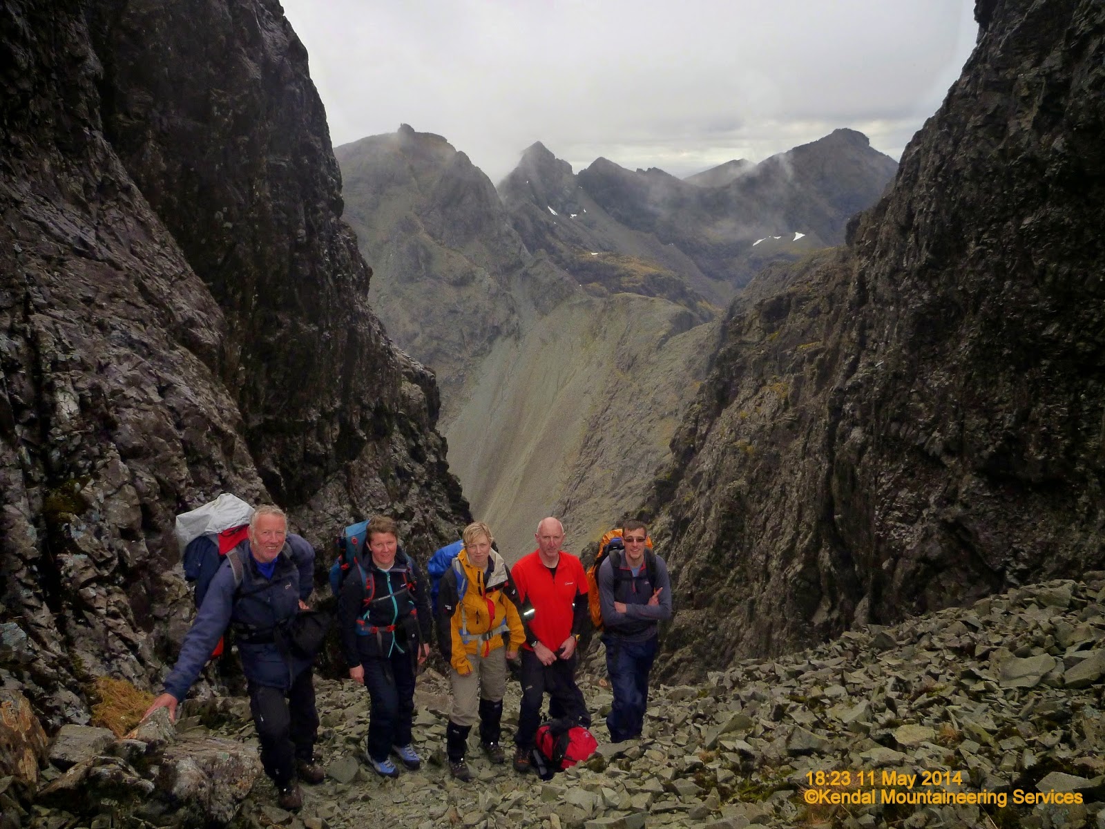
Our first sight of Sgùrr Dearg just before descent down
TheGreat Stone Chute
Next was the descent down The Great Stone Chute. By now it was getting late and so we did not have time to ascend the Munro Top Sgùrr Thearlaich, I think we had had enough excitement for one day anyway. So after photos and admiring the view towards InPin we set off down. Probably the most exhilarating part of the day, so we had not had enough excitement? - Approx. 800m descent in less than 500m down one of the biggest screes in the UK. A spectacular setting but believe me there was not a chance of admiring the scenery, just absolute concentration on staying up right on a greater than 1:2 incline and not sliding down the stones that were continually shifting below your feet. Thank goodness for trek poles.


Weather closing in behind the tired group
descending from Loch Làgan into Coire Làgan
By the time we reach the bottom and gathered around Loch Làgan I think it is safe to say we were all pretty bushed. At least we had done all the hard bits for the day. All that was left was 600m of descent and 3 miles walk back to the cars.

Kendal Mountaineering Services blog page
If like me you are just the average hill walker with no climbing expertise and limited scrambling experience, but have set yourself the target to climb all the Munros. Have you thought about how you will reach the 11 Munros on the Cuillin Ridge, Isle of Skye. From what I have read and now seen you will have no chance unless you know an experienced climber with knowledge of the Cuillins. Iain Gallagher of Kendal Mountaineering Services is just such a man. He has a lifetime of mountaineering experience along with a detailed knowledge of the Cuillins including safe scrambling routes along with entry and exit routes to take the safest option whatever the conditions might be or indeed change whilst out on the hill.

I found his services on line and paid the £425 for one weeks accommodation and 4 days guided walking (scrambling and climbing) in the Cuillins. Excellent value. 4 days guided walking alone could cost you that much. This price really includes food as well, because each member of the group, including Iain, supply a home cooked meal each day, creating a brilliant atmosphere and get together at the end of the day with everyone else in the team.

Team is just what you are part of, supporting each other throughout the day ensuring each and every one of us reaches our own goals as well as at times extend outside your own comfort zone and edge of achievable limits.

A brilliant experience. No kickbacks or commissions, but I cannot recommend this trip highly enough and thank Iain most sincerely for enabling me to extend myself beyond limits I never thought possible. As I have read somewhere "you do not know your limits or what you are capable of achieving  until you start to venture beyond your limits."

Iain provided the opportunity and maintained the safe environment to do just that.

As well as taking copious amounts of photographs he also records the days events on his own blog to provide lasting memories of a trip of a lifetime. Here is his account of Day01 activities on the Cuillin Ridge - Sgùrr Nan Eag to Sgùrr Alasdair 

Walk Statistics
Walk Date - 11 May 2014
Walkers - Iain Gallagher (ML Kendal Mountaineering Services), Steve Smith, Al Simpson, Helen McD, Don, Alison L
Accommodation - Carbost, Isle of Skye
Start Point - Loch Brittle campsite & car park (NG 40968 20602)
Start Time - 09:05
Finish Point - Loch Brittle campsite & car park (NG 40968 20602)
Finish Time - 20:26
Duration - 11hrs 21mins
Average pace - 0.82mph
Distance Walked - 9.36miles
Height Ascended - 2066.33metres

Other walks on this trip
2014
May
08th The Tyndrum Handful
11th Cuillin Ridge Day01 - Sgùrr nan Eag, Sgùrr Dubh Mòr & Sgùrr Alasdair
12th Cuillin Ridge Day02 - Sgùrr Mhic Choinnic

13th Cuillin Ridge Day03 - Sgùrr a'Mhadaidh
15th 
Cuillin Ridge Day04 - Sgùrr nan Gillean & Bruach na Frithe

18th Comb Moss

Peaks visited

Munro (282)
Sgùrr nan Eag (13)
Sgùrr Dubh Mòr (14)
Sgùrr Alasdair (15)
Murdo (443)
Sgùrr nan Eag (20)
Sgùrr Dubh Mòr (21)
Sgùrr Dubh na Da Bhein [Sgùrr Dubh an Dubh Bhein] (22)
Sgùrr Alasdair (23)
Corbett (221)
NONE
Graham (224)
NONE
Marilyn (1218S - 1552E,W&S))
Sgùrr Alasdair (18S - 89E,W&S)
Hump (2168S - 2976E,W&S)
Sgùrr nan Eag (21S - 142E,W&S)
Sgùrr Alasdair (22S - 143E,W&S)

Route
Our days route as plotted on my GPS tracklog.
Please do not think without the necessary experience or knowledge of The Cuillins this is the basis of a route you can tackle alone or even part of a determined group. The contours are simply too close together along with scree, outcrop, boulder and loose rock symbols so arbitrary, that plotting a route from your armchair or even on the ground are just too complex.
More Photographs
As mentioned earlier I was carrying too much stuff in my pack and did not have room for my own camera. It's usual place strapped to my utility belt was not appropriate with all the scrambling and climbing I was likely to be doing. So other than a few snaps on my mobile, all of today's photos have been provided by Kendal Mountaineering Services and other members of the group.
Our first sight of Sgùrr Dearg - The Inaccessible Pinnacle just before descent down The Great Stone Chute
Click on photograph to view slide-show