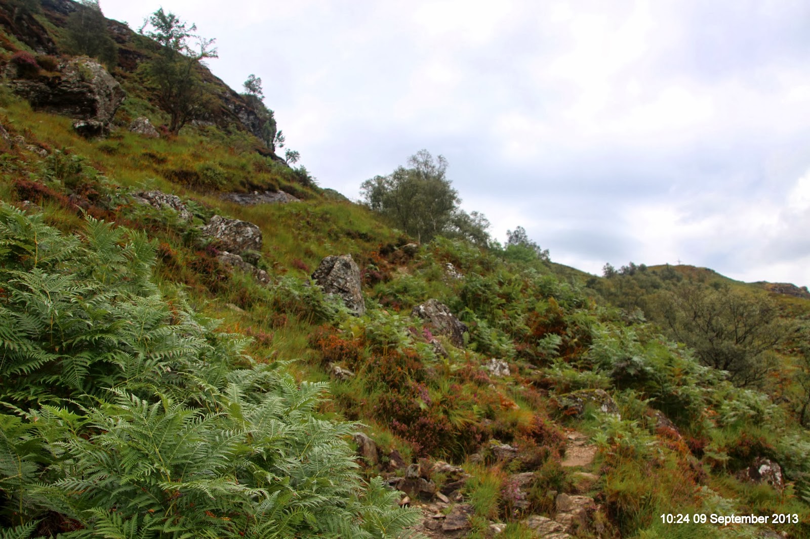
.

Monday, 9 September 2013

Beinn Chabhair

Walk Statistics
Walk Date - 09 September 2013
Walkers - Steve Smith, John Parkin
Accommodation - Pine Trees Leisure Park, Tyndrum
Start Point - Beinglas Farm campsite (GR NN 32116 18695)
Start Time - 09:50
Finish Point - Beinglas Farm campsite (GR NN 32116 18695)
Finish Time - 16:30
Duration - 6hrs 40mins
Average pace - 1.09mph
Distance Walked - 7.26miles
Height Ascended - 998.88metres

Other walks on this trip
2013
September
14th The Glen Lyon Horseshoe
13th Tarmachen Ridge
12th Meall Ghaordaidh
  9th Beinn Chabhair
  7th Ben Chonzie
  6th Ben Vorlich & Stuc a' Chroin

Peaks visited
Munro (282)
Ben Chabhair (4)
Corbett (221)
NONE
Graham (224)
NONE
Marilyn (1216)
Ben Chabhair (7)
Hump (2168)
Ben Chabhair (7)

Route
GPS tracklog of actual walk
Walk Summary
Main objective for today's walk is the Munro - Beinn Chabhair a lone top in site of An Caisteal and Beinn a' Chroin; tantalisingly close enough to consider bagging these two peaks on this walk as well.
The OS Explorer map did not offer any clues other than a confused spaghetti of contours without any obvious feature such as a wall or ridge to use as a navigational aid, certainly not a marked footpath. On the other hand there were not too many concentrations of tightly packed contours. Guide books suggested it was a possible option but tough, well we got that from the contours.
With this in mind we set off from Bienglas campsite with the intention we would give it a go if an obvious route became clear. Otherwise we would leave them for another day and make do with bagging four of Bein Chahairs Graham Tops of Munro, including Bein Glas on our return from the days Munro.
As it turned out an obvious path did not materialise though a possible route after our lunch location provided temptation it was filed away as a possible return route if we decided to continue past the main Munro. But for now we concentrated on the main objective for the day and press on to Beinn Chabhair.
At least two false summits later along an easy to follow path and both with a steep assent we eventually got sight of the summit cairn and after a final effort reached the summit and enjoyed all round views including the massive of Loch Lomond to the south and Ben More to the north.
The sun also made an appearance which persuaded us to linger with other baggers of the day and enjoy the warm September sunshine.
However this was short lived to the west we could see black storm clouds in 2 clusters and it looked like they were heading our way soon. By the time we had returned to our lunch venue the storms had merged, cloud closed in and it was raining steadily persuading us to head home rather than diverting upwards to bag the four Graham Tops; Ben Glas, Stob Creag an Fhithich and the twin Meall nan Tarmachan tops.
The boggy ground we had crossed on the way up was even more boggy resulting in us failing to mirror our outward route. But the path down to Beinglas farm was clear enough and steep enough to be grateful I had trek poles with me to take the weight off my knees and ankles after what had been a very tiring day.
Mission accomplished Beinn Chabhair had successfully been bagged. We had missed out on the Graham tops and never got round to An Caisteal and Beinn a' Chroin. In all honesty they never were an option from this start location. Most disappointing was having lunch within 100m of another peak namely Meall nan Tarmachen, but like all the hills they will be there another day.

Walk Description
Beinglas campsite bar and shop at Inveranan
 0.) First job was to buy a very reasonably priced £1 parking ticket for the days parking from Beinglas campsite bar.
Steep ascent ahead and to the right after crossing West Highland Way
 1.) From the bar we turned left and east to cross the West Highland Way before starting a steep ascent towards Creag an Fhéidh.
Broken stile above Beinglas campsite
 2.) Early on in the ascent use broken stile to cross fence marked on OS Explorer map.
Stay this side of fence below Ben Glas waterfalls
 3.) Next you will reach waterfalls on Ben Glas Burn half way up ascent. Stay this side of fence until you reach a second more solid stile.
For the last part of climb ascent seems to get even steeper
 4.) After climbing over stile ascent does not get any easier other than the fact you are nearer the top than when you started. Carry on following the obvious path to the top.
Nameless falls of Ben Glas Burn.
I have called them Fan Falls until the correct name is known
 5.) Once at the top you will join a distinct track from the north it soon transforms in to a path which at times becomes a boggy smear, continue heading east keeping north of Ben Glas Burn until you reach some unnamed waterfalls.
Unlike ourselves stay on the path left and higher,
away from Lochan Beinn Chabhair
 6.) Follow path up left side of falls and continue on towards Lochan Ben Chabhair
Head for the notch high up on your left.
 7.) With the lochan straight ahead, look to your left and follow path up to notch.
The peak on the left edge is the Graham Top of Munro
Beinn Chabhair - Meall nan Tarmachan
 8.) At base of notch follow path round to your right, then descend left to base of Meall nan Tarmachan before turning right and ascending to a small unmarked loochan just south of 719m spot height and summit of Meall nan Tarmachan.
Lunch venue,
small Lochan on east side of Beinn Chabhair - Meall nan Tarmachan
 9.) We had lunch near this lochan. Did not bother with bagging twin peaks of Meall nan Tarmachan as intended to bag all four Graham Tops of Munro - Bein Chabhair on way back.
2nd big climb since lunch and still no sign of Beinn Chabhair
10.) The path continues around and then to the west of the lochan. Expect at least two further ascents up what could be considered false summits. Avoid going right over the tops, the path tends to lead you around the right side anyway.
Beinn Chabhair summit area.
Ben Lomond beyond
11.) When you reach the final ascent there is no doubt it is not a false summit.
Beinn Chabhair cairn and summit
12.) Any time spent at the summit is time well spent especially if the sun is shining.
Path continues east from Beinn Chabhair cairn
but not really an option today for a circular walk home
via An Caisteal and/or Beinn a Chroine
13.) John did inspect option to continue west along path from cairn, then north and down towards Am Caisteal and Beinn a Chroine. But although it did look possible it looked too far and hard work for us today without an obvious path down. There would be only just enough daylight and from my point of view would require a rest day tomorrow. So might as well save energy today and have two days walking rather than one hard day and one rest day. For it to be an option the best place to start would be tomorrow's start point from the lay-by on A82 opposite Keilator Farm and pull in Beinn Chabhair from An Caisteal/Beinn a Chroine walk rather than the other way round.
Time to head home. Rain heading our way from Breadalbane Hills
14.) So the best option for us was to return home and head back towards Meall nan Tarmachan along the route we took on the way up. Especially with gathering storm clouds on distant hills.
More rain to the left of Ben Lui and Ben Oss
15.) The plan was to visit the four Graham Tops of Munro around Lochan a Chaisteil but looking beyond to Ben Lui & Ben Oss more storm clouds gathering and look to be heading our way.
45 minutes after leaving Beinn Chabhair summit
we are down to Lochan Beinn Chabhair
16.) So at the unnamed lochan where we had lunch our chosen option was to descend to Lochan Beinn Chabhair with bothering to pull in the Graham Tops.
Boggy trudge west along Ben Glas Burn - try and stay on faint path
17.) Follow faint path wher visible for a further 1½ miles to start of descent to Beinglas Farm campsite
Troisgeach opposite at end of boggy trudge,
start of descent to BeinGlas and Inveranan
18.) Just before start of descent more or less after crossing a feeder stream to Ben Glas Farm there is a less steep descent route to the north along an established track. We took the path off the track on the left and took the steeper but shorter descent option down the path we followed on the way up. 
Time for a pint at Benglas campsite
19.) The final stage though not compulsory is to have a pint from the welcoming bar at Beinglas Farm campsite then return to camper van to left of buildings.

More Photographs
Ben Chabhair summit with Ben Lomand and Loch Lomand beyond
Click on photograph to view slide-show

Saturday, 7 September 2013

Ben Chonzie

Walk Statistics
Walk Date - 07 September 2013
Walkers - Steve Smith, John Parkin
Accommodation - West Lodge Caravan Park, Comrie
Start Point - Coishavachan car park (GR NN 74301 27278)
Start Time - 10:49
Finish Point - Coishavachan car park (GR NN 74301 27278)
Finish Time - 15:12
Duration - 4hrs 23mins
Average pace - 1.90mph
Distance Walked - 8.34miles
Height Ascended - 760.28metres

Other walks on this trip
2013
September
14th The Glen Lyon Horseshoe
13th Tarmachen Ridge
12th Meall Ghaordaidh
  9th Beinn Chabhair
  7th Ben Chonzie
  6th Ben Vorlich & Stuc a' Chroin

Peaks visited
Munro (282)
Ben Chonzie (3)
Murdo (443)
Ben Chonzie (3)
Corbett (221)
NONE
Graham (224)
NONE
Marilyn (1216)
Ben Chonzie (6)
Hump (2168)
Ben Chonzie (6)

Route
GPS tracklog of actual walk
Walk Summary
Ben Chonzie was originally planned by John P. as the first peak of the trip and therefore my very first Munro. However when I started reading that it was a boring hill and comments that it would put me off hill walking for life I did start (for about 1 nano-second) to have mixed feelings about it being the first. Quite frankly I can not imagine any hill, let alone a Munro, could put me off hill walking, unless of course a John Lewis or Debenhams had opened near the trig point.
Anyway when the forecast for Saturday was rain John decided to do Ben Vorlich & Stuc a' Chroin yesterday on the basis we would still be able to do Ben Chonzie if visibility was poor.
As forecast it was raining when we left the campsite, driving through rain along Glen Lednock. But by the time we had arrived at the start point and kitted up, we set off in bright warm sunshine from the car park towards Coishavachan Farm. All I could think about was the lush green fields, white sheep and the contrasting grays and browns towards the high fells - how is this boring.
Yes the navigation following the track for the next 1¾ hours and 3 miles is straight forward, but the relentless ascent provides an aerobic work out second to none, not to mention the fresh air, wildlife and spectacular views.
For me there was also a twist. The big lump we had walked towards and round was not Ben Chonzie. The summit was about 400m to the NW. Clearly if I had studied the map before setting off this would not have been a surprise, but for once I was just happy to follow John and let him worry about the navigation.
Verdict - Ben Chonzie is not a boring Munro at all. I do not believe there is such an animal. What has occurred to me though is that it is an excellent candidate for a last Munro. Whilst not taking any walk for granted (even on this walk the wind was cold and strong enough on the summit to not hang around and to don hat and gloves) the straight forward navigation and close proximity to a suitable start point makes it ideal as a last top to be joined by friends not quite so keen to disappear in to the Scottish Highlands for the whole day or even longer. 
But for me that is a question I will not have to consider for about 280 summits and several years.

Walk Description
Coishavachan from walk start point
 1.) Leave car park following track north towards Coishavachan Farm.
Last look at van and walk start point from Coishavachan.
 2.) At the end of the track turn right in front of the farm then left after going through gate as you pass the last building. If you look back you should see your vehicle in the car park. 
First Invergeldie Burn crossing. Follow road through gate and round to the right
 3.) Continue heading north with Coishavachan Farm on your left and cross Invergeldie Burn after trees in grounds of Invergeldie Lodge.
The days only summit - Ben Chonzie after first crossing Invergeldie Burn
 4.) Walk away from Burn and follow track round to your right where you will then see the days peak of Ben Chonzie over the burn in the distance ahead and to your right.
Ford over Invegeldie Burn near small dam
 5.) Continue on track and recross Invergeldie Burn at ford near the small dam.
Small cairn marks top of track
from where you drift left along path to Ben Chonzie summit
 6.) Stay on track for a further 1½ miles ascending nearly 500m to the end of track marked by small cairn (I think it is this bit which gives Ben Chonzie its unfair reputation as a bit of trudge).
Keep to top of rocks then follow fence at the top
 7.) From the cairn as the track is replaced by a path that replaces track that drifts to the left, follow it to the top of a large rocky outcrop.
Follow fence to the west for the easier ground and as a navigation aid, 
 8.) At the top of the rocks you will find a line of old fencing. I was expecting the summit to be straight ahead, however if I had studied the map more carefully I would have been prepared for it being across to the right.
Follow fence to the right at 910m contour
Ben Chonzie summit will be straight ahead to the north
 9.) In clear conditions you can cut off the corner near the 910m contour, however at times of poor visibility or severe weather conditions it is as well to handrail the fence all the way to the summit.
A big black cloud has appeared on our way down
10.) Return home can be a reverse of the ascent but at the 910m contour we carried straight on and joined the track more or less due south of the fence corner.
Starting to rain as we rejoin track we followed on ascent. 
11.) I did find a small cairn that marked the point where we joined the track and therefore a marker to go for the summit from here, but on balance I think the ascent route is easier to stay on the track and follow the route we took.
After an hours walk through heavy rain nearly back at Coishavachan
12.) Turn right on to track and follow it all the way back to the ford and small dam. On the way down I met a guy who had delayed starting because of the wet morning and decided to give it a go when it cleared up. He was now heading up-hill in the pouring rain. So pleased we got on with our day as planned.
Invergeldie Burn crossing in middle of picture.
Coishavachan and walks end is behind trees right of bridge
13.) Once at the ford you are nearly home and all that remains is to follow the track back past Coishavachan Farm and on to the car park and walks end.

More Photographs
Windy & Cold on Ben Chonzie summit

Friday, 6 September 2013

Ben Vorlich & Stuc a' Chroin

Walk Statistics
Walk Date - 06 September 2013
Walkers - Steve Smith, John Parkin
Accommodation - West Lodge, Comrie
Start Point - Off road parking near Ardvorlich House (GR NN 63231 23205)
Start Time - 10:12
Finish Point - Off road parking near Ardvorlich House (GR NN 63231 23205)
Finish Time - 18:21
Duration - 8hrs 09mins
Average pace - 1.32mph
Distance Walked - 10.75miles
Height Ascended - 1519.88metres

Other walks on this trip
2013
September
14th The Glen Lyon Horseshoe
13th Tarmachen Ridge
12th Meall Ghaordaidh
  9th Beinn Chabhair
  7th Ben Chonzie
  6th Ben Vorlich & Stuc a' Chroin

Peaks visited
Munro (282)
Ben Vorlich (1)
Stuc a' Chroin (2)
Murdo (443)
Ben Vorlich (1)
Stuc a' Chroin (2)
Corbett (221)
NONE
Graham Top of Munro (194)
Ben Vorlich - Creagan nan Gabhar  (1)
Ben Vorlich - Ben Our  (2)
Marilyn (1216)
Ben Vorlich (4)
Stuc a' Chroin (5)
Hump (2168)
Ben Vorlich (4)
Stuc a' Chroin (5)

Route
GPS tracklog of actual walk
Walk Summary
After all the planning, pontificating and pouring over maps the identity of my first Munro, assuming I stay upright for the next 2 to 3 hours, is now known. Ben Vorlich (Loch Earn), shrouded in cloud, is the Munro before me as we set off from the southern shores of Loch Earn towards Ardvorlich House from Haugh Bridge
Whether it is worthy as a first Munro for anybody, only time will tell and not just for today. I suspect, if it is anything like choosing the hill to be my last English Nuttall, my ability to choose a first Munro can only truly be applied after I have climbed a significant number. Now there’s a paradox to sort out.
Joined and planned by my walking mate who I met at Kettlewell Youth Hostel while walking Great Whernside, Yockenthwaite Moor & Buckden Pike back in April 2011, this trip is a departure from my previous trips in as much as I have had nothing to do with planning the route and hence do not have a clue about the route we will be following today.
All I know is 2 Munros are on the agenda; Ben Vorlich (Loch Earn) and Stuc a’ Chroin. The first difference to the English Nuttalls that struck me is the sheer scale of the landscape. There were no intermediate summits to break up the ascent and so after over 3 miles with over 850 metres of relentless ascent I was pretty breathless by the time we reached the summit 2½ hours later. It was warm work but soon chilled off as the cloud closed in more or less at the same time we were on the first summit. Because of the cloud we could not see the next peak so set off for Stuc a Chroin oblivious of what lay before us.
As we descended west then south of Ben Vorlich I took what I thought was one last look at the trig point through the mist at my first Munro. A combination of us descending below the cloud line and the cloud clearing revealed Stuc a Chroine NW Butress straight ahead. To me it looked quite daunting while at the same time appealing so we both agreed it was most likely not as difficult as it looked. In any event there is an easier but longer route to the right up the Allt a' Choire Fhuadaraich gully if necessary. We did manage the buttress, it turns out it is a grade 1 scramble, not sure if it was as bad as it looked but it was by far the hardest scramble I had attempted on any of the English & Welsh Nuttalls.
Arriving at the top well out of breath the cairn at the top briefly raised my spirits we were at the summit but soon remembered the top was a further 500m to the south. It was on Stuc a’ Chroin summit I realised I had lost my glasses. Well cheesed off for managing to lose something so important at the beginning of the trip I was well chuffed when we met another walker on his way to Stuc a’ Chroin who had seen a black pair of glasses on Ben Vorlich trig point. That was the good news. The bad news was he left them their as there was no chance he would come across the keeper. I would never have considered going back without this information, but knowing they had been seen there I had no choice but to return to my first Munro a lot sooner than I ever thought would have been likely. As I approached the summit for the second time I saw another couple taking photos. By the time I collapsed on the top gasping for breath, but only after finding out they had packed them away to take down and then report as “lost & found” on the walkhighlands website. After a quick recovery and smiles all round I then set off for the original return route over the 2 Graham Tops of Ben Vorlich; Creagan nan Gabhar and Ben Our.
 At over 8 hours of walking it would be very hard to manage both peaks in short winter day, especially if winter conditions prevailed. But with longer September days it is a real bonus to be able to bag 2 Munros in one day, both of which are Marilyns with the 250m drop between them, as well as managing a circular walk to include 2 other significant peaks.

Walk Description
Meall a' Mhadaidh an unclassified sub top of Meall Buidhe
across Loch Earn from walk start point
1.) We parked the van on off road parking on the shore of Loch Earn opposite Ardvorlich House
Add caption
2.) Start by walking east along the road towards Haugh Bridge where just before on the right is a memorial stone to the McDonalds killed near here in 1620 some 72 years before the "Massacre of Glencoe". The inscription reads "Near this spot were interred the bodies of 7 MacDonalds of Glencoe killed when attempting to harry Ardvorlich Anno Domini 1620."

3.) Cross Haugh Bridge and turn immediately right down the drive to/from Ardvorlich House.
Looking down on Ardvorlich House
4.) Stay on drive and look out for conveniently place signs to guide you to the open access land.
As we reach tree line following track,
looks like cloud is trying to lift off Ben Vorlich
5.) Going through first gate takes you out of Ardvorlich House gardens and on to an easy to follow track all the way to bridge crossing over Allt a' Choire Bhuidhe.
Looking back at Loch Earn and steady ascent up easy to follow path
6.) After crossing the bridge over Allt a' Choire Bhuidhe the track fades to a path and ascent increases to the west of tongue that eventually becomes Sgiath nam Tarmachan
Cairn confirms still on track
7.) From here the path is easy enough to follow but if visibility deteriorates cairns mark the way along Sgiath nam Tarmachan.
Final push to the summit
8.) By the time we reached the top of Sgiath nam Tarmachan we had been walking uphill relentlessly for nearly 2 hours and still there was a long way to go to the next ridge. Hope it is not a false summit.
The summit party - Steve Smith & John Parkin
9.) It was not and I had reached my very first Munro summit - Ben Vorlich (Loch Earn)
Last look back as we leave Ben Vorlich on the way to Stuc a' Chroin
10.) The cloud closed in during our time on the summit. But there was still an obvious path to the west to follow. Although there is a wall marked on the map there was no evidence of it on the summit so extra care was taken to make sure we stayed to the left as we descended the summit. In winter conditions I do not think we would have the time or the energy to go on to a second summit of the day and would have to be satisfied with just the one summit for the day.
Stuc a' Chroin NE Buttress our route to the next summit
11.) We had not gonefar when the cloud lifted and/or we had descended below the cloud line. To our left we could see the route to the next summit via Stuc a' Chroine NE Buttress.
Walk to right of first hill then drop to bealach
before following path to base of the buttress
12.) There is an alternative albeit longer route  to the right via Allt a' Choire Fhuadaraich gully that avoids the scramble up the NE Buttress but we both fancied the scramble and as we approached we were studying the crag and likely route of ascent.
The only stop on the scramble to look back at Ben Vorlich
13.) Follow the path which takes you to the left end of the scree slope at the base of the buttress. From the base of the buttress at the right end of the screes.
Pointing camera over my shoulder at last part of scramble
14.) From the start of scree stay on grass diagonally up to the right until come to large stone bottom middle. Climb up left side of stone and continue following grass path to the right until it turns sharply to the left for the final ascent to the top.
John waiting at Stuc a' Chroin NE Butress cairn.
Yes I know this is not the summit
15.) As you top out on a scramble do not be fooled by the cairn immediately in front of you.
Stuc a' Chroin summit on the left, approx. 500m from NE Buttress cairn
16.) The summit is 500m beyond on the left at the end of an easy to follow path.
Stuc a' Chroin cairn and summit. Ben Vorlich beyond
17.) Whilst checking map for route back I discovered my glasses had fell out of my pocket. Oh no first day and lost something already.
The lower SW cairn on Stuc a' Chroin.
18.) After photos of the summit cairn I decided to visit the other and lower cairn to the SW just to be sure I visited the summit.
On our way down, turn right at next bealach on the left.
Route home is over tops centre right
19.) Descent route is back towards NE buttress cairn staying left to pick up path to bealach at top of Allt a' Choire Fhuadaraich gully. On this section we met a lone walker and I asked him in wild hope if he had seen  a pair of glasses. "Black ones?" he asked. "Yeah why have you got them?" Er, no they were on Ben Vorlich trig point and I left them as there was no chance of meeting the owner"
Ben Vorlich beyond Stuc a' Chroin NE buttress
20.) Descending the gully looking at the steep slope on Stuc a' Chroine NE Butress on the right my mind was racing with questions.
What should I do? Have I enough energy to go back to Ben Vorlich? What will John say? Can I manage without my glasses? "Crikey they cost £100".
John helped suggesting "You might as well go back for them."
Ben Vorlich (Loch Earn) second visit. A lot clearer than this
morning - looking towards lower twin top to the south east
21.) "I'll meet you on the next top" So off I went on my own (see map for route taken) It was a bit of a rush though I could see people on the top and was hoping they would not go down with the glasses. Exhausted I reached the top. The people had hung around taking photos over the last hour taking advantage of the changing light conditions.
"Have you seen any glasses" I asked "Yes" they said digging them out of their backpack. We were going to advertise them on walkhighlands web site.
After descending Ben Vorlich you will then have to reascend the
Graham Tops of Ben Vorlich - Creagan nan Gabhar and Ben Our
22.) The route off Ben Vorlich was the same as this morning, except I tended right to the Graham Top ridge of Ben Vorlich instead of left to Stuc a' Chroin. But their is an easy enough path to fallow all the way to the bealach.
Creagan nan Gabhar.
Ben Vorlich's other Graham Top - Ben Our beyond and next
23.) The path tends to disappear in places on the ascent to the first summit Ben Vorlich - Creagan nan Gabhar so but does reappear as you reach the summit. Not a problem for us on a clear day we just kept going up hill with the benefit of seeing the high point if the cloud is low still keep going uphill but keep an eye on the old map & compass.
Approach to Ben Our summit from the south
24.) There is an obvious path heading north to the next summit Ben Vorlich - Ben Our
More than 1 hour after leaving Ben Our get sight of van and walks end
25.) Following the path north from Ben Our summit we were hopeful this would take us all the way down to either the road or the path we came up from Ardvorlich House. Unfortunately it disappeared somewhere around Sròn Mhòr so we decided to head down the east side of the hill into Glen Vorlich and join up with the track we followed on the way up Ben Vorlich and return to the van on the shore of Loch Earn

More Photographs
Proud as punch on my first Munro - Ben Vorlich (Loch Earn)
Click on photograph to view slide-show